
Mississippi Delta, USA
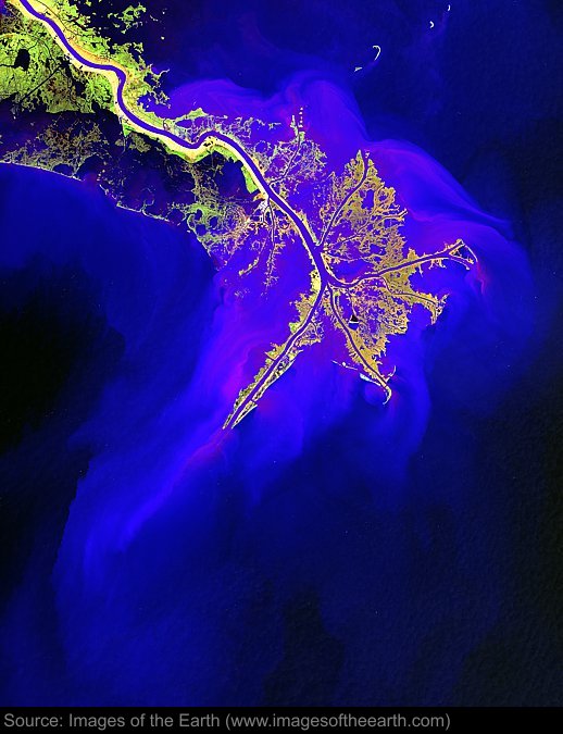
Approximate image footprint: 92 X 115 km
Coordinates: 29.14N, 89.24W
Date: March 05, 2001
Satellite sensor: Landsat 7 ETM+
Raw data credit: NASA
Spectral range: Enhanced infrared composite
Click HERE to purchase an 8 X 10 photographic enlargement for only $5.45 (more sizes are available).
Images on this site were compiled by Paul Illsley.
Return to Images of the Earth homepage.
|