
About: Paul Illsley
Isle Haute National Wildlife Area
Nova Scotia, Canada
These prohibitions are in place to protect migratory birds, their nests and eggs, as well as sensitive Indigenous archeological records." (Source: Government of Canada's National Wildlife Area website)
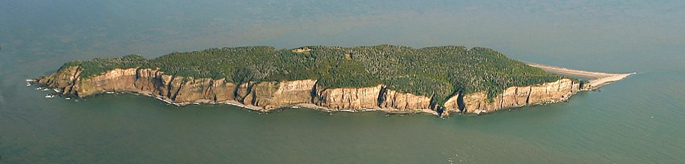
2009 aerial view of the south side of Isle Haute
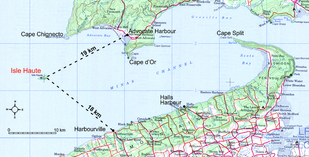
Map showing the location of Isle Haute in the Bay of Fundy
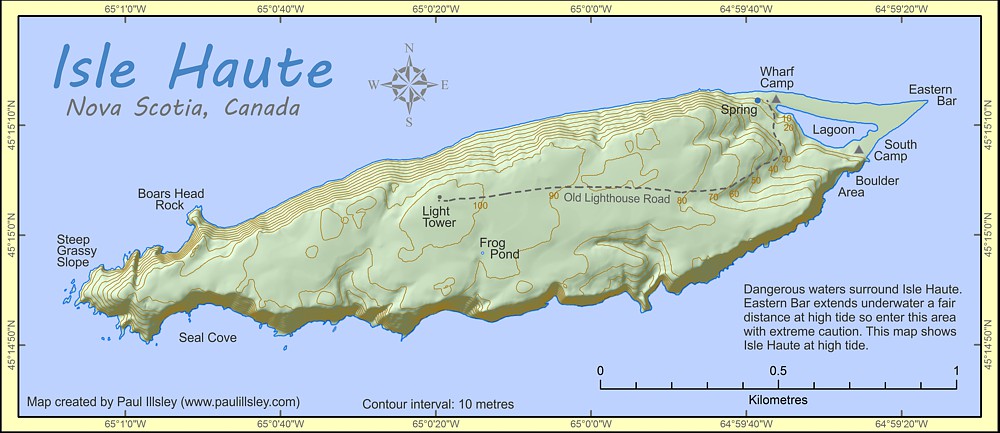
Map of Isle Haute (high tide)
Lighthouse Keepers:
Capt. Nelson Card (1878 - 1889)
Judson Reid (1889 - 1904)
Percy Morris (1904 - 1941)
Donald Morris (1941 - 1946)
John Fullerton (1946 - 1956)
Documented Shipwrecks near Isle Haute (Marine Heritage Database):
Unknown Name, September 01, 1786 (unknown type)
Riverside, January 26, 1888 (wooden schooner)
Lima, October 20, 1890 (wooden schooner)
A. Elliott, November 13, 1890 (wooden schooner)
T. W. Mckay, March 23, 1898 (wooden schooner)
Gleaner, March 29, 1899 (wooden schooner)
Hattie Mckay, July 26, 1900 (wooden schooner)
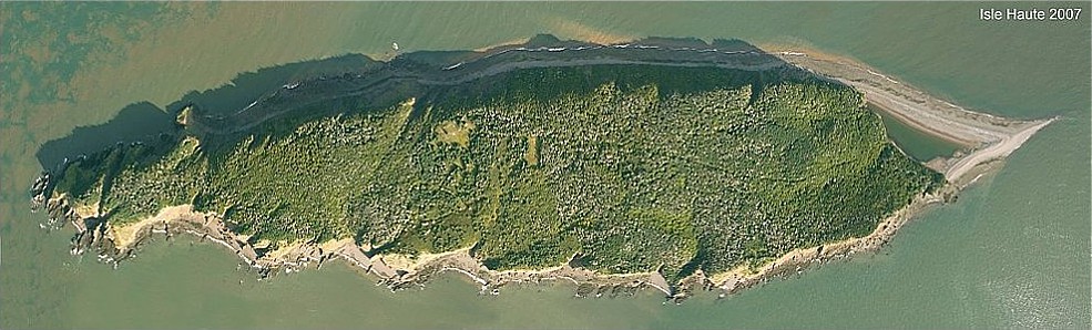
2007 aerial view of Isle Haute
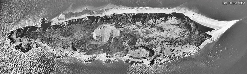
1951 aerial view of Isle Haute
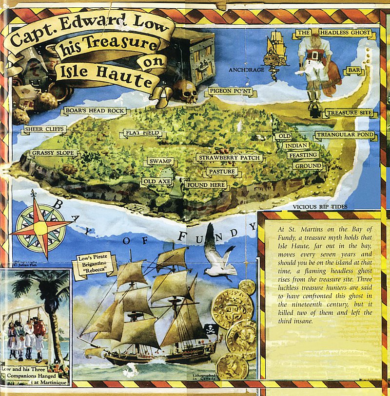
Map from a 1960 breakfast cereal box drawn by Julian Fish
from "Pirates of the Atlantic" (2009) by Dan Conlin.
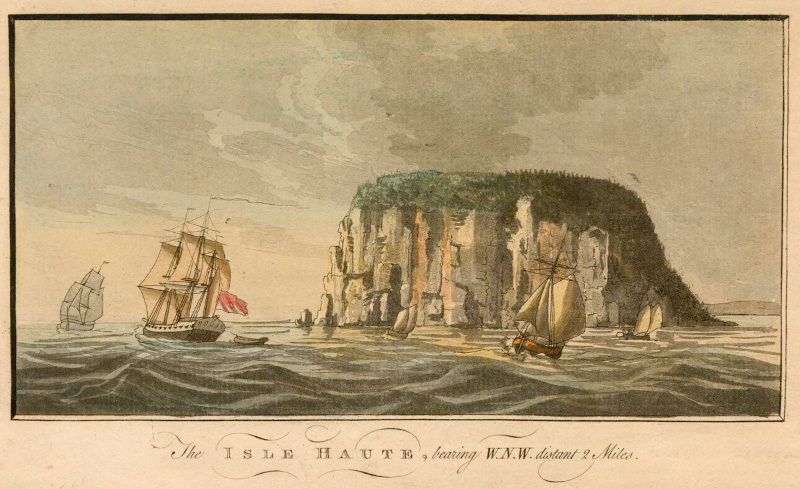
1780 Des Barres, Joseph F.W. (Joseph Frederick Wallet), 1722-1824 (artist)
Card from the Baldwin Collection of Canadiana at the Toronto Public Library (object #JRR2141) Public Domain
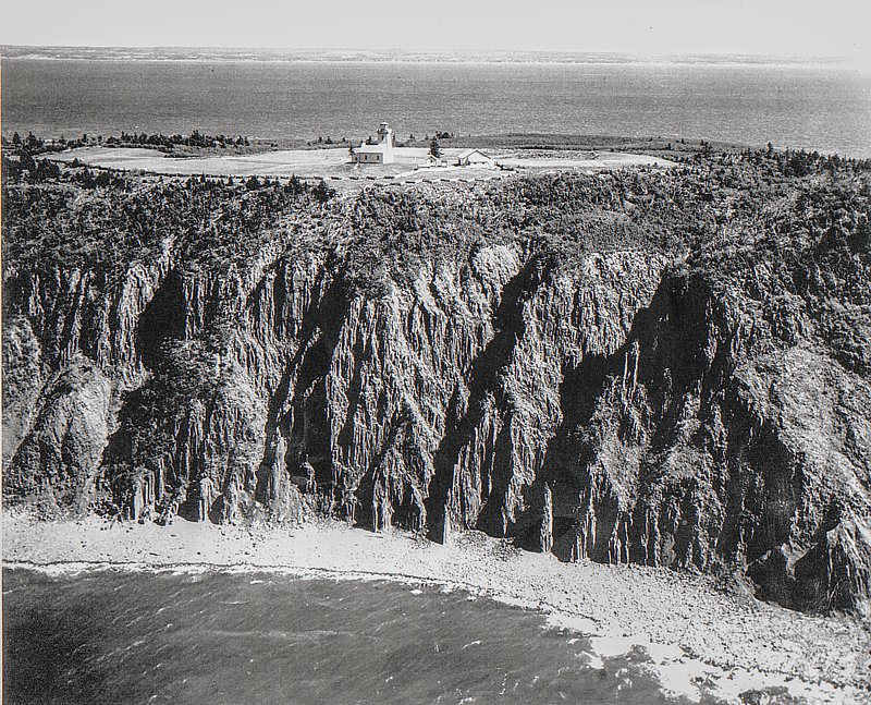
Aerial view of the north side of Isle Haute (looking south) (circa 1944)
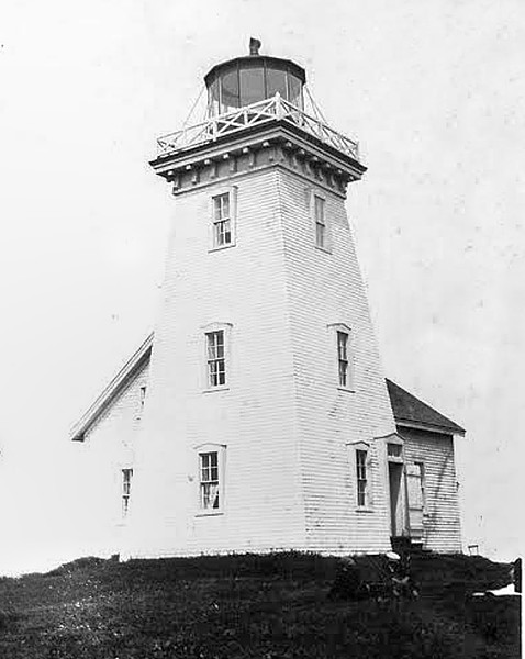
1933 image of the Isle Haute Lighthouse (burned down in 1956)
(image source: Kings County Museum)

Download Dan Conlin's 1997 report on Isle Haute (5.7 MB .pdf)
Images of Isle Haute recorded by Paul Illsley (2009)
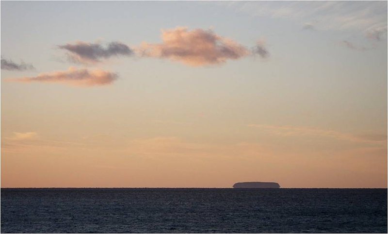
Evening view of Isle Haute from Harbourville
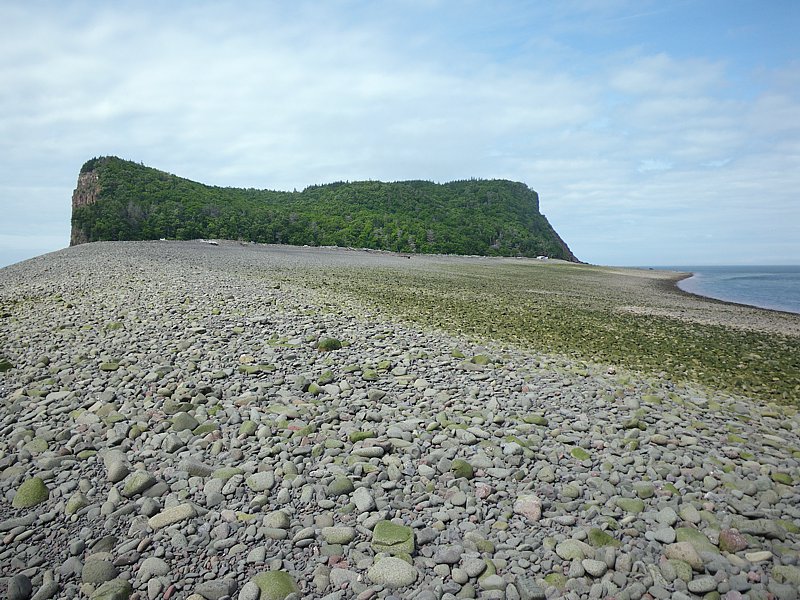
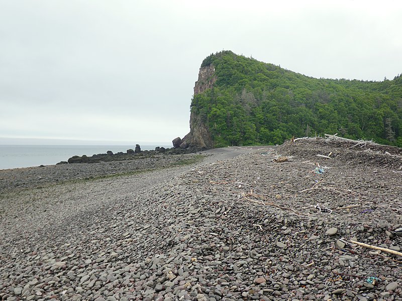
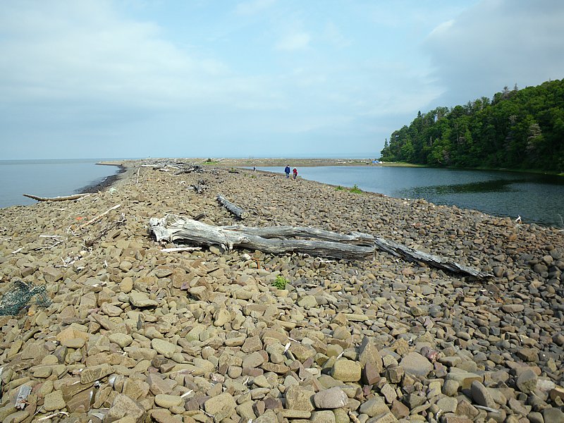
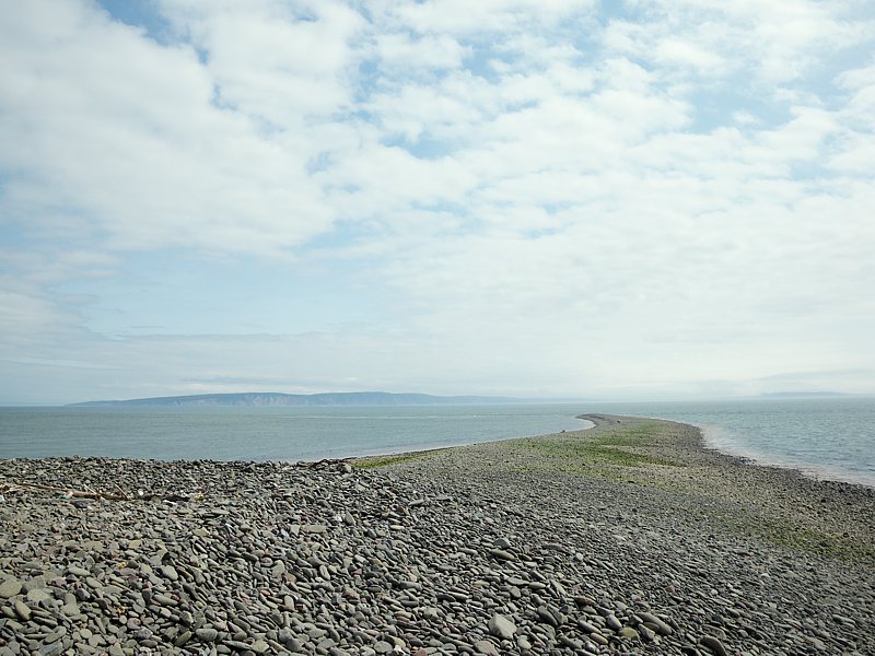
View of Isle Haute from the Eastern Bar at low tide
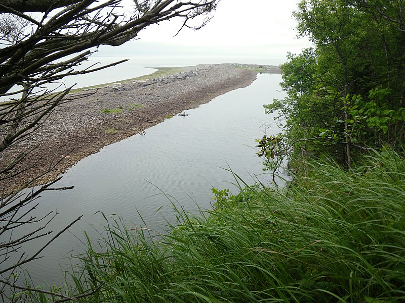
View of the Eastern Bar at low tide
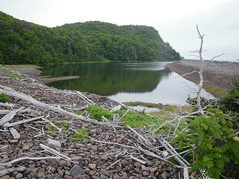
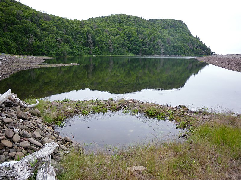
View of the Lagoon from the Eastern Bar
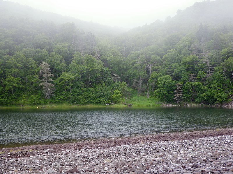
View of the Ravine and Lagoon on a foggy morning
View of the Lagoon from the Eastern Bar
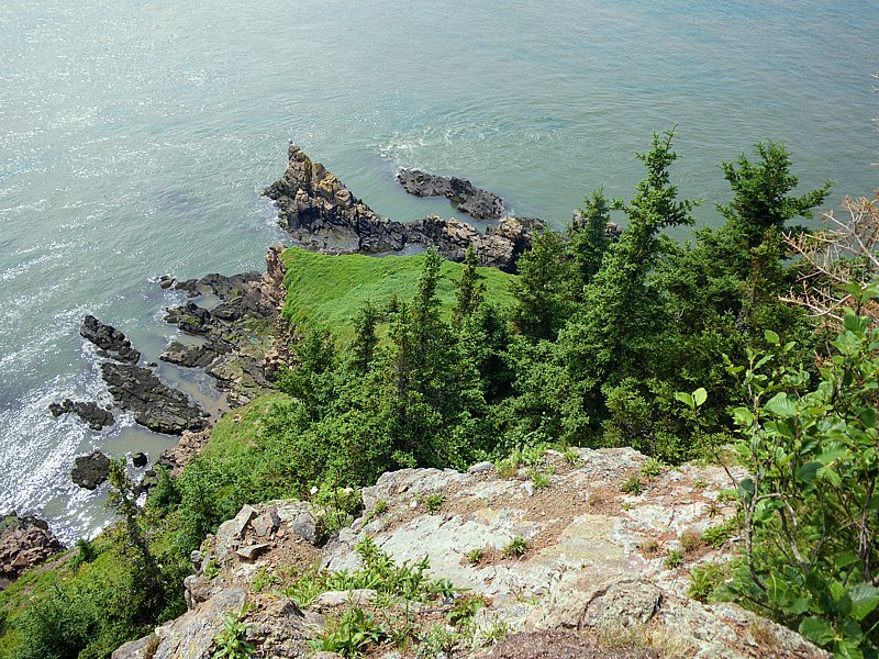
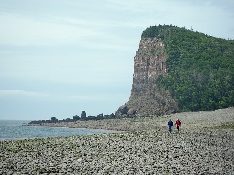
Cliff on the south end of the island near the Lagoon and Eastern Bar
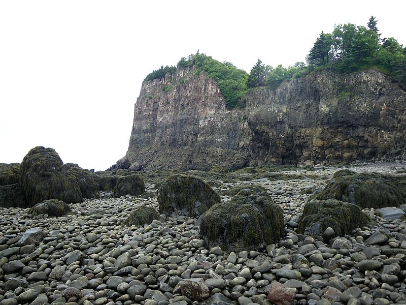
Cliff on the south end of the island near the Lagoon
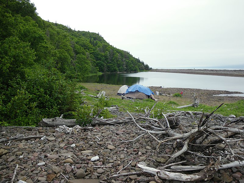
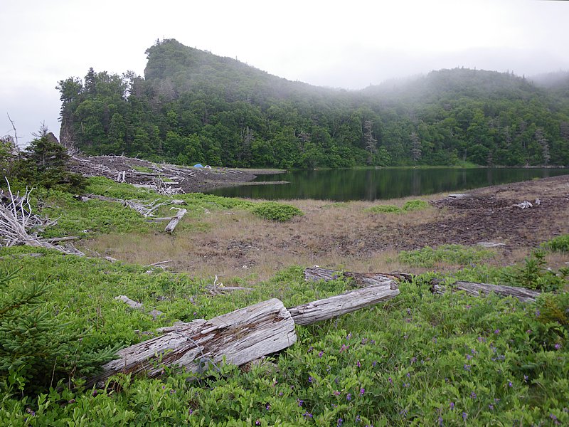
Camp site on the south side of the Lagoon
Lagoon with a watter filled pit in the foreground
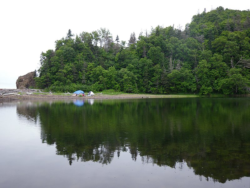
Camp site on the south side of the Lagoon
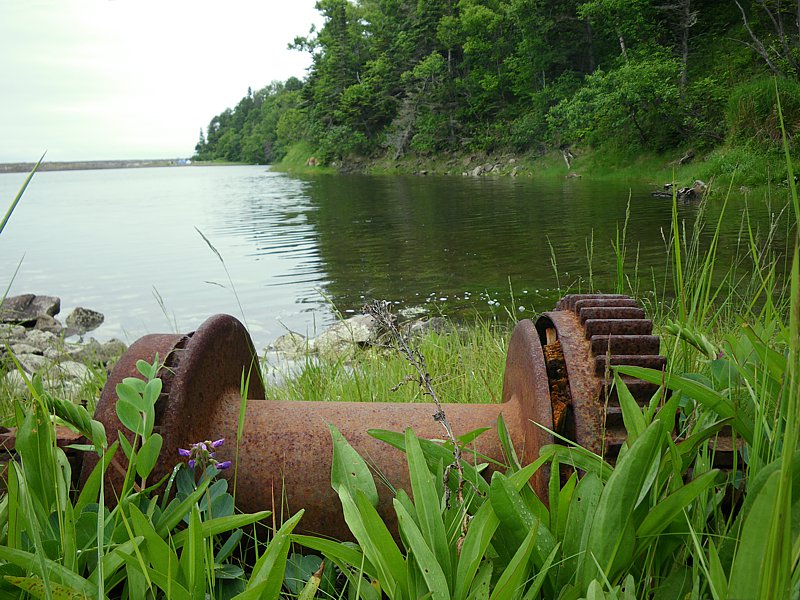
Abandoned winch gear once used to pull boats up on the beach
View of the Lagoon from the trail up to the Lighthouse
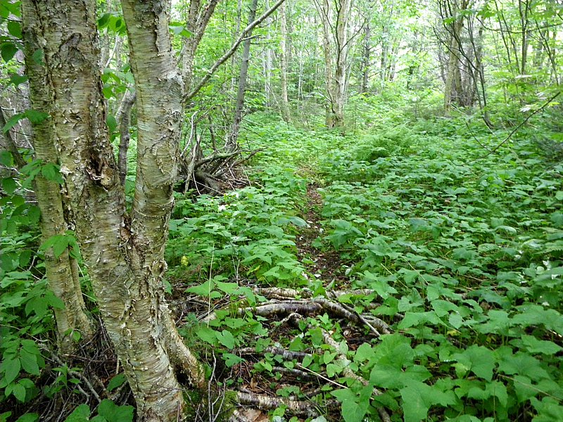
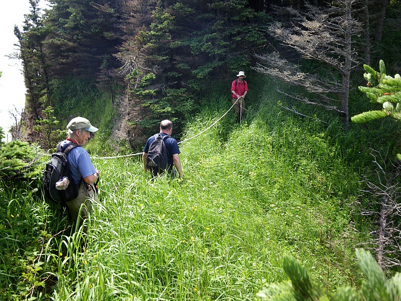
Trail up to the Lighthouse
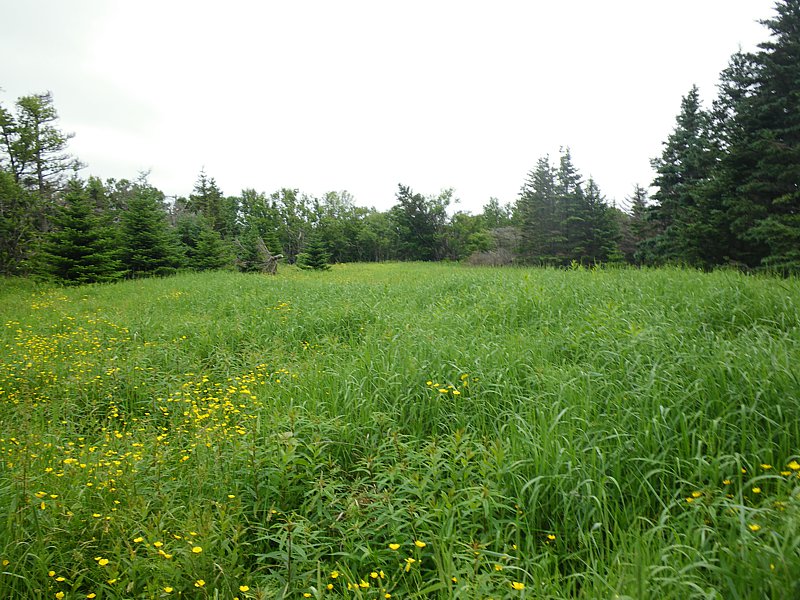
Long Grassy Field on route to the Lighthouse
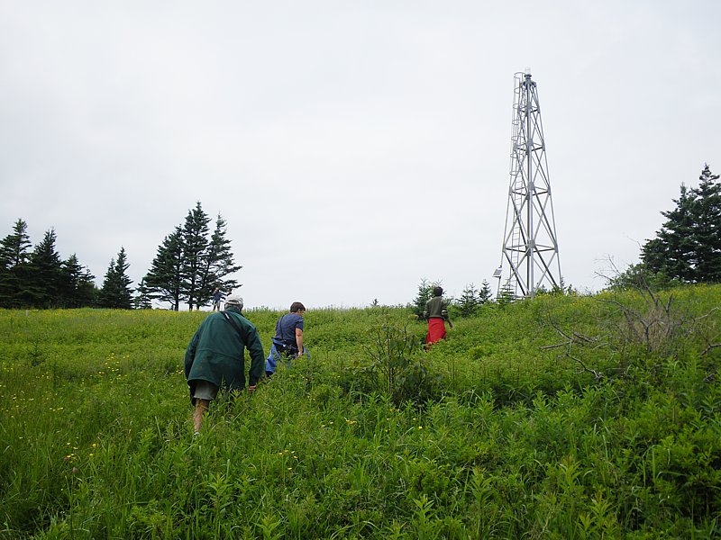
Approaching the site of the former Lighthouse (now replaced by a light tower)
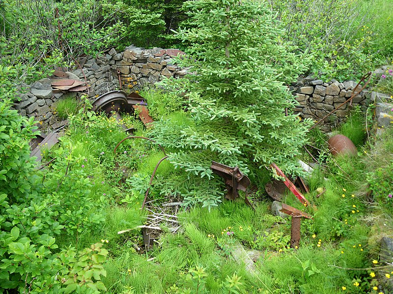
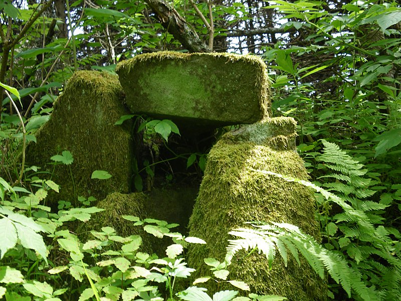
Stone foundation of the old lighthouse (burned in 1956) filled with old abandoned equipment
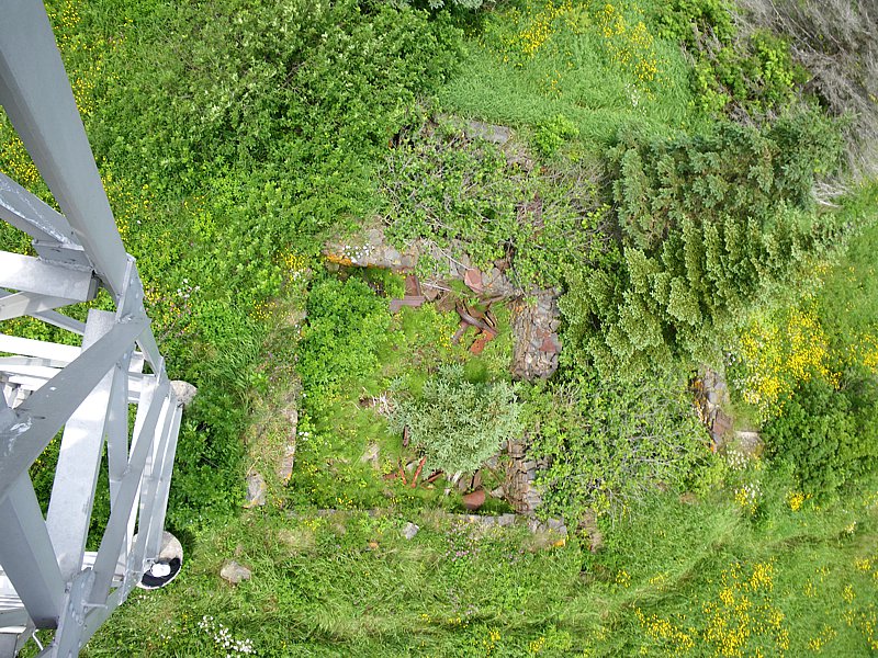
Vertical view of the old foundation from the light tower
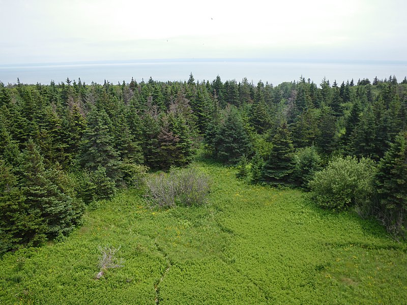
View from the tower looking south toward Kings County
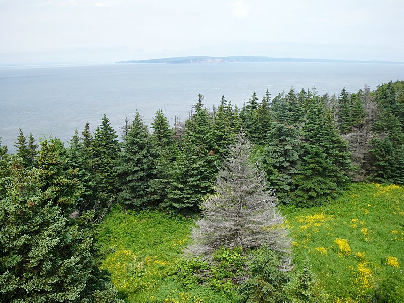
View from the tower looking east toward Cape Chignecto
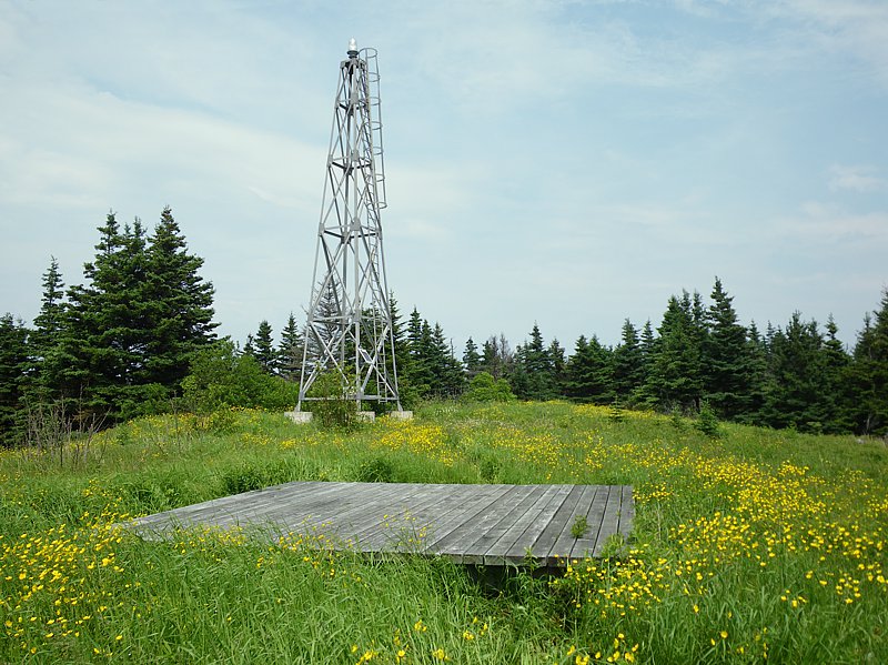
Light tower with the helipad (used to maintain the light) in the foreground
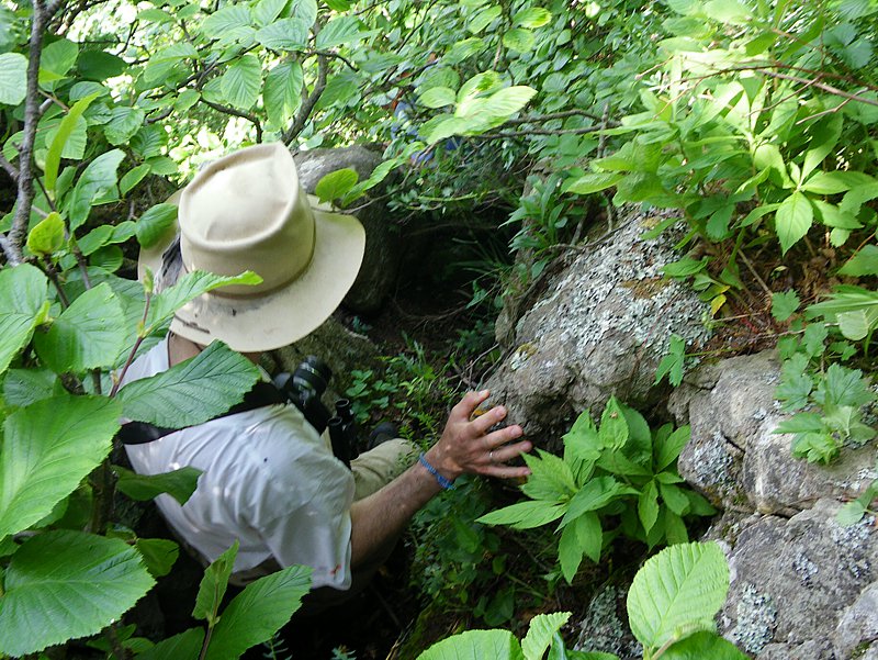
Remnants of old infrastructure on route to the west end of the island
Steep cliff along the route to the west end of the island
West end of the island showing the Knife Edge and Steep Grassy Slope (north side)
Crossing the Knife Edge to reach the Steep Grassy Slope (not recommended)
View of the Steep Grassy Slope from atop the west cliff
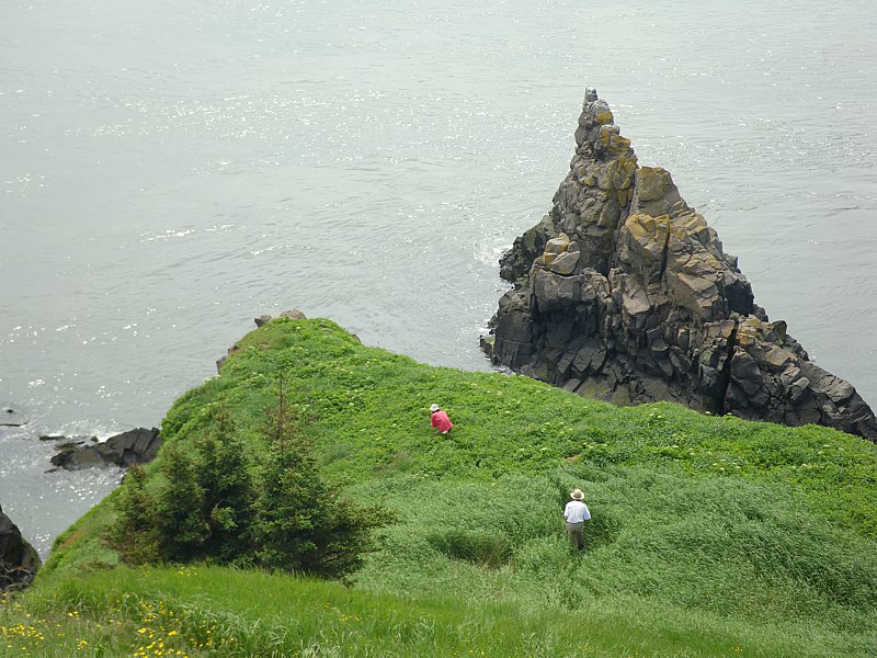
Making our way down to the Steep Grassy Slope from the west cliff
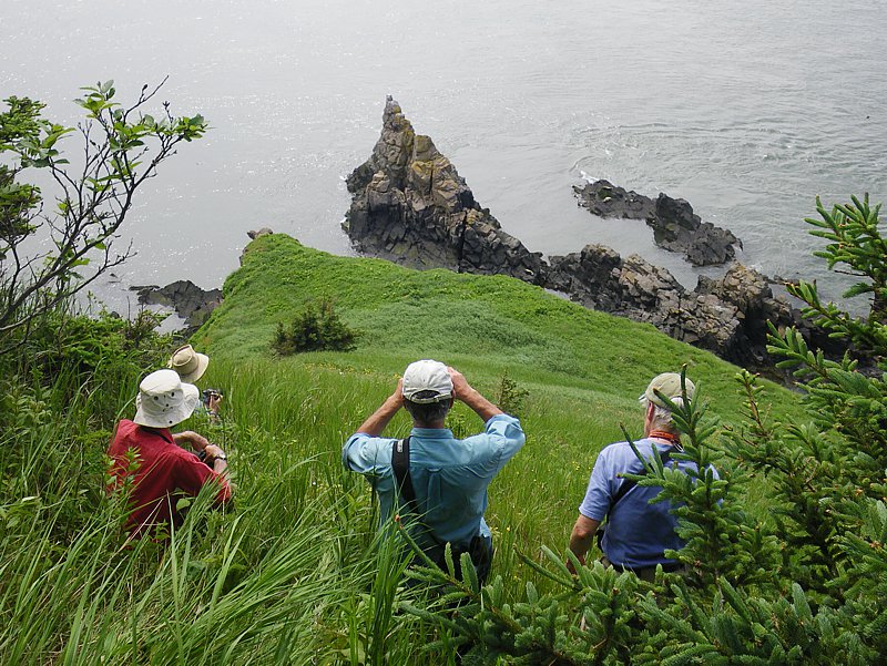
Pausing at the top of the Steep Grassy Slope to look for seals and birds
Working our way down the Steep Grassy Slope
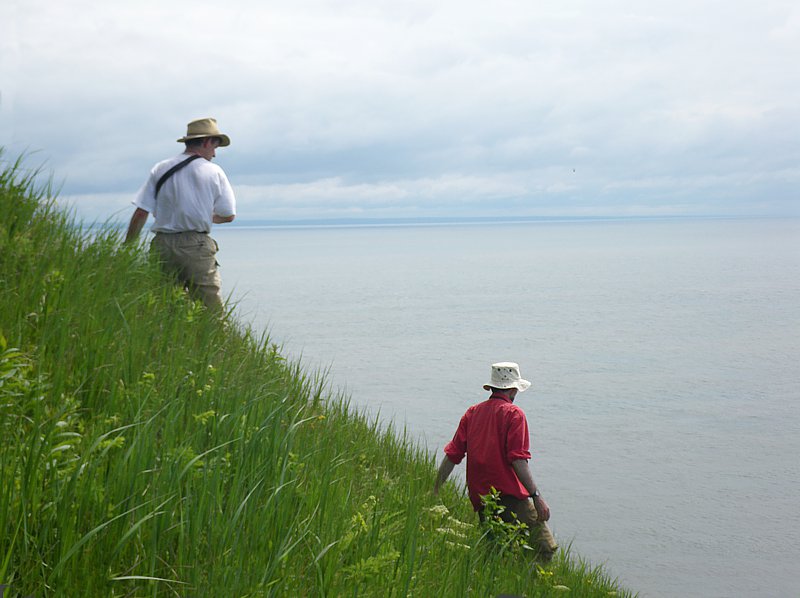
Walking through the deep grass at the bottom of the Steep Grassy Slope
View of the Steep Grassy Slope and south side of the island
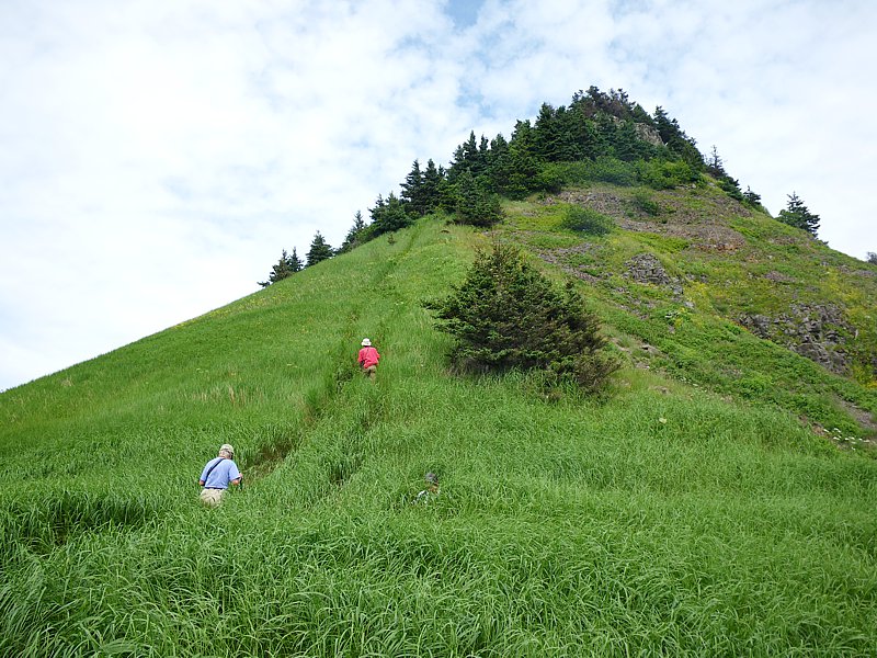
Heading back up the Steep Grassy Slope toward the west cliff
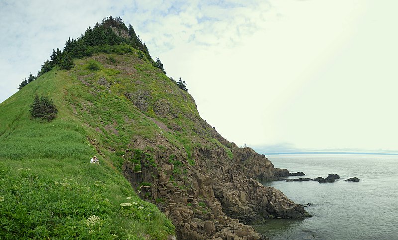
Distant view of the west end of Isle Haute showing the Steep Grassy Slope and west cliff
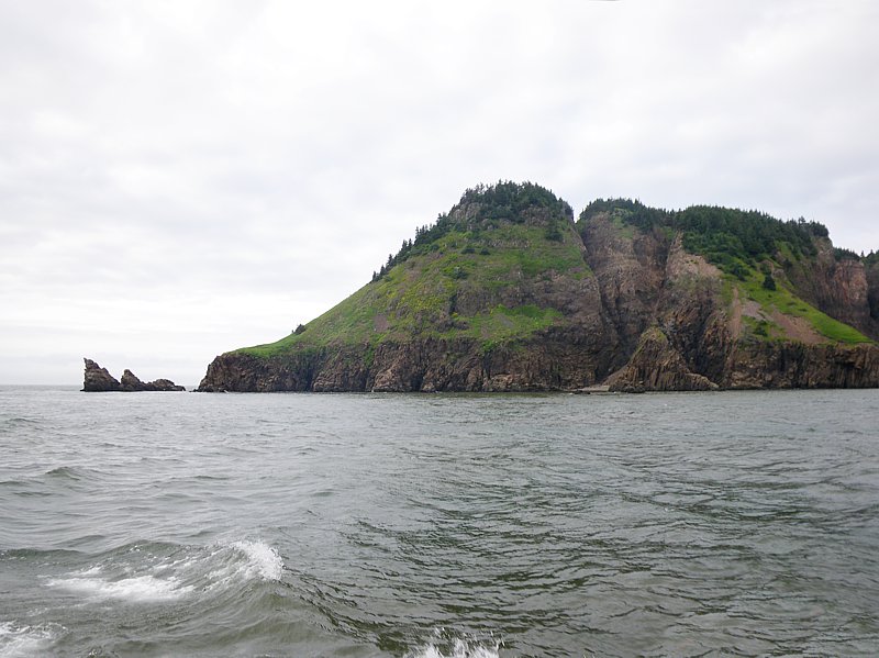
View of the east end of the island showing the Steep Grassy Slope and Knife Edge (south side)
View of the Lagoon from the Lighthouse trail trailhead
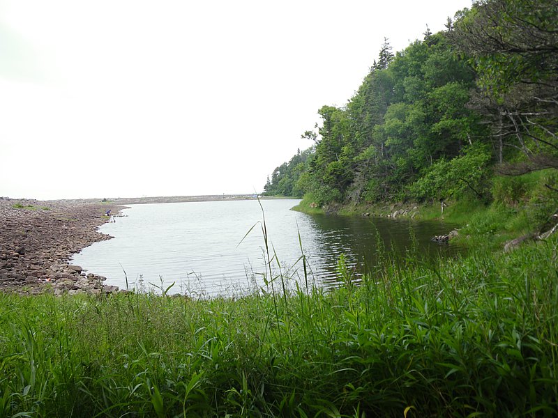
View of the Lagoon and beach at high tide
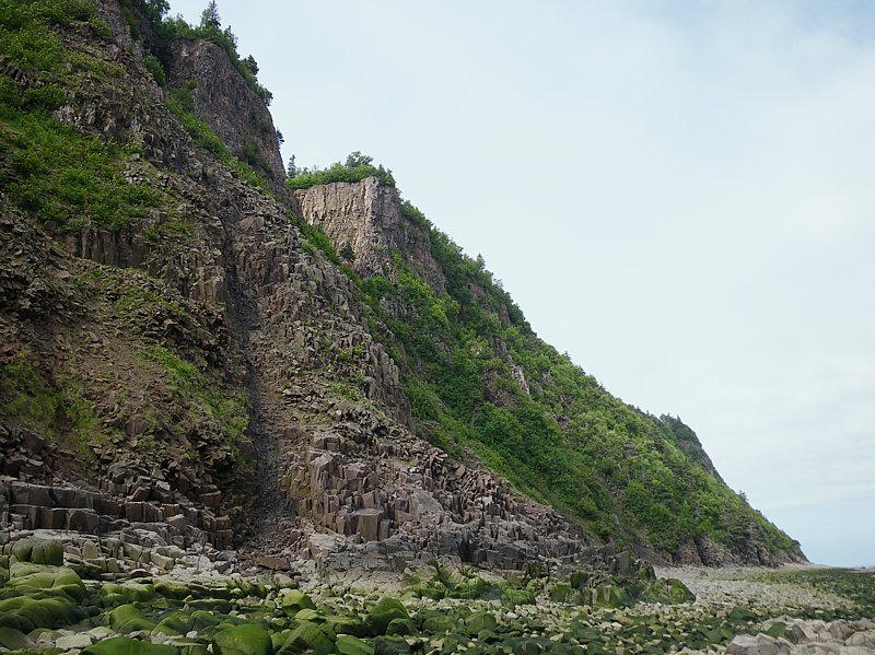
Basalt cliff on the north shore (showing columnar jointing)
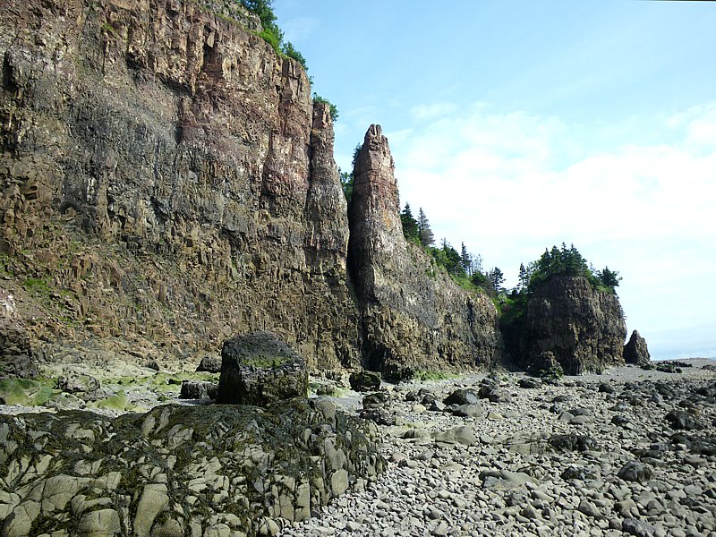
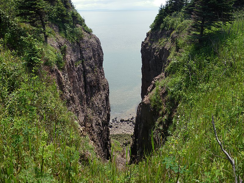
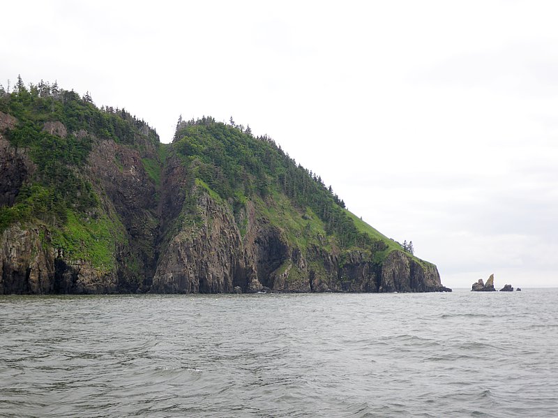
Vertical cliff on the south side of the island (looking east)
Vertical cliff on the south side of the island (looking west)
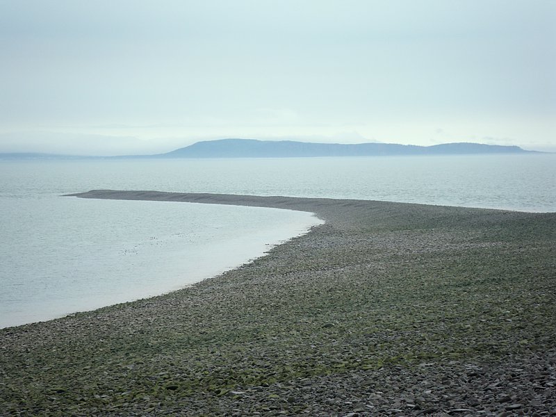
View of the Eastern Bar from the Lagoon burm at low tide
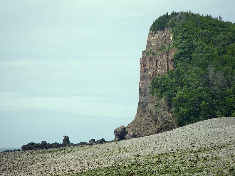
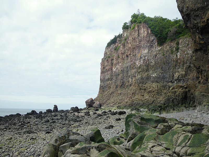
Cliff on the south end of the island near the Lagoon
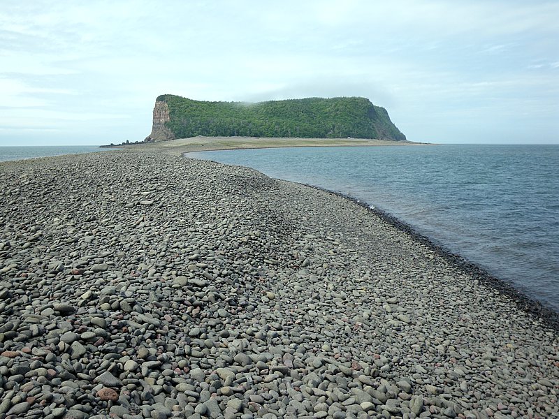
View of Isle Haute from the Eastern Bar
Cliff on the south end of the island from the Eastern Bar
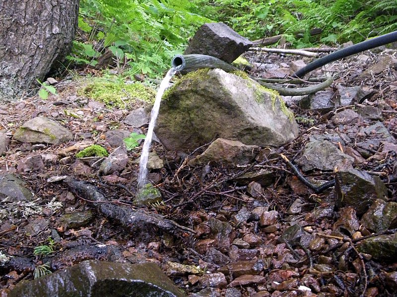
Fresh water spring located west of the Lagoon (mentioned by Samuel de Champlain in 1604)
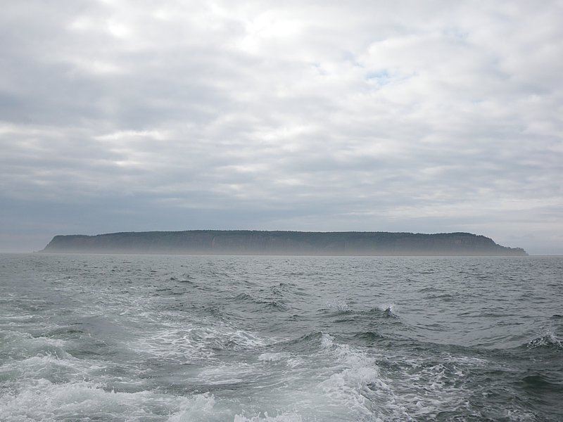
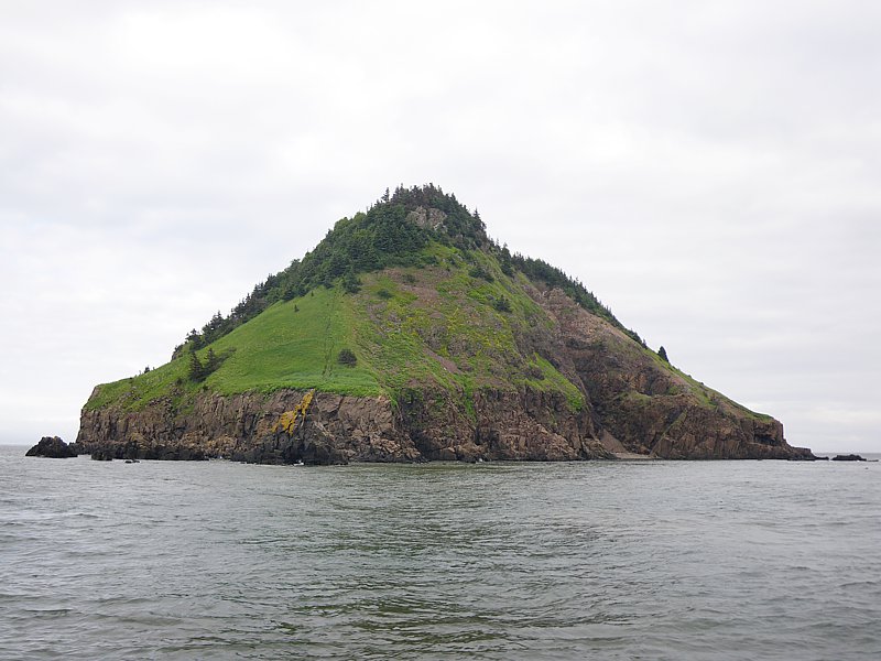
Distant view of the south side of Isle Haute
Return to Paul Illsley's home page