Iceland
The Golden Circle
Golden Circle Map
The Golden Circle is one of the most popular tourist routes in Iceland. Depending on how long you spend at each site, it is possible to easily visit most of these sites by car in a couple days. The traditional Golden Circle route includes; Reykjavík, Þingvellir National Park, Geysir Hot Springs Geothermal Area, Gullfoss, Kerið Crater and Reykjadalur Hot Spring Thermal River, but this guide includes a few sites that may not be listed in other guides (Þórufoss, The Cave People of Laugarvatnshellar, Brúarfoss and Rauðhólar Pseudocraters Park) in case you have extra time to explore the area. Be aware that parking at many sites around Iceland requires payment, so take a look around when you arrive to see if you need to pay for parking.
Hallgrímskirkja Church (Reykjavík)
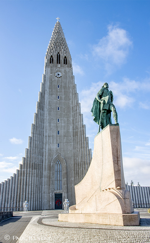
Hallgrímskirkja Church
Our journey begins at Hallgrímskirkja Church in the center of Reykjavík; the city’s best-known and most prominent landmark. This 74.5m tall sentinel is the largest church, and tallest structure in Iceland. It took 41 years to build (1945 - 1986). The Church’s unique exterior design is said to represent a striking geological formation known as, “columnar basalt formations” which can be found throughout Iceland. It is possible to tour the interior of the church, and take a lift up to the viewing deck at the top providing a spectacular bird’s eye view of the city and surrounding landscape. A statue of explorer Leif Erikson is located in front of Hallgrímskirkja Church. The statue was a gift from the United States (1930) in honor of the 1000th anniversary of the convening of Iceland's first Parliament held at Þingvellir in 930 AD.
To find this location on Google Maps: Click Here
Sólfarið (The Sun Voyager) in Reykjavík
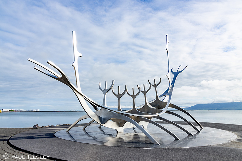
Sólfarið (The Sun Voyager)
After spending some time at Hallgrímskirkja Church, and exploring the many attractions in Reykjavík, we make our way down to the waterfront where we find the stainless-steel sculpture Sólfarið (The Sun Voyager). According to its designer Jón Gunnar Árnason, it is intended to depict a dream boat and is an ode to the sun. It represents the promise of undiscovered territory, and a dream of; hope, progress and freedom. Sólfarið was commissioned to commemorate the 200th anniversary of the founding of the city of Reykjavík, and was unveiled on August 18, 1990.
To find this location on Google Maps: Click Here
Þórufoss Waterfall
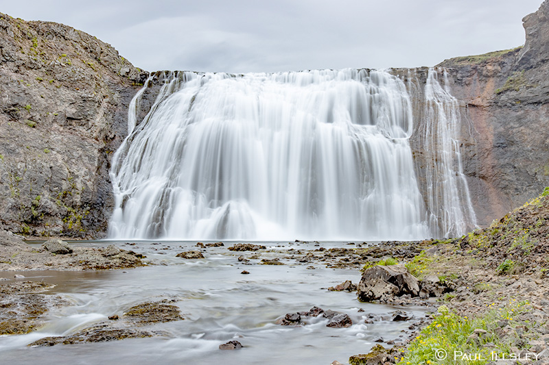
Þórufoss Waterfall from the riverside trail
After exploring the museums, restaurants and shops around downtown Reykjavík, and taking time to admire the Harpa Concert Hall and Conference Centre just 550m west of The Sun Voyager we head outside of the city toward our next Golden Circle destination (National Park), but just before we get to the park, we will take a quick diversion to visit Þórufoss waterfall. This impressive 16m (54 ft) tall wall of water on the Laxá River can be vied from a parking area just downriver from the falls or you can take an unmaintained trail from the parking area back upriver to the base of this 30m (100 ft) wide waterfall. From Sun Voyager we have traveled a total of 36km (22 min) on Route 41 – Route 49 – Route 1 (North) – Route 36 – Route 48. Þórufoss will be on our right-hand side. This site is not normally listed on the traditional Golden Circle route.
To find this location on Google Maps: Click Here
Þingvellir National Park
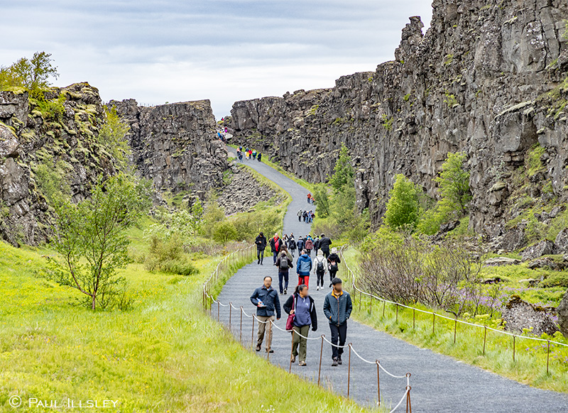
Almannagjá Gorge
After exploring Þórufoss waterfall we drive back down Route 48 (south) and turn left onto Roure 36 (northeast) to Þingvellir National Park (18.2 km, 16 min). Þingvellir, meaning “Assembly Plains”, is one of the most visited sites in Iceland, and was awarded UNESCO World Heritage status in 2004.
After exploring the park’s visitor centre, we take a stroll through the Almannagjá gorge that is said to represent the geological boundary between the North-American and Eurasian continental plates. Near the end of the Almannagjá gorge trail (1.6km) we can relax beside the Öxarárfoss waterfall. Take some time to explore some of the trails in the area such as Dead Man Walk and Langistígur before heading 1 km back along the gorge trail to reach the turnoff to Lögberg (Law Rock).
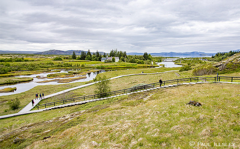
Lögberg was the place where the LawSpeaker took his seat during the assembly of the Althing (Supreme National Parliament of Iceland). The Lögberg was active from 930 AD until 1262 when Iceland took allegiance to Norway (Iceland became an Independent Republic on June 17, 1944). From this prominent point we can view the Öxará River and historic structures Þingvallakirkja & Þingvallabær just 250m to the southeast.
The current Þingvallakirkja (Church of the Parliament Plains) was constructed in 1859 but the Icelandic Sagas (a famous collection of prose narratives which recount the founding of Iceland by the Norse indicate a church has occupied this site since 1017. This church is usually closed, but can be booked for special occasions by contacting the park staff.
Þingvallabær which are the houses next to the church were built in 1930. The houses were initially intended to be the office for the park´s supervisor but today are the official summer residence for Iceland´s Prime Minister.
A 650m stroll east of Þingvallabær brings us to Silfra Fissure which is said to contain some of the clearest water in the world with visibility of often 100 meters or more. For a price, you can rent dry suits and take a guided swim through the crystal-clear frigid water that fills this unique geological structure (snorkel or SCUBA). A short 800m walk eastward returns us to the park’s visitor center.
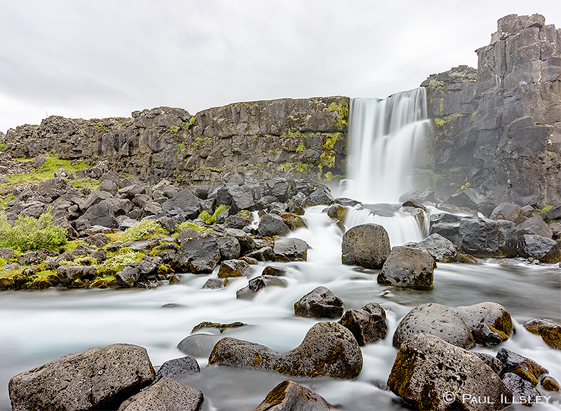
Öxarárfoss
View of Öxará River, Þingvallakirkja and Þingvallabær from Lögberg
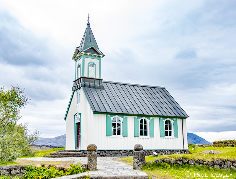
Þingvallakirkja (Church of the Parliament Plains)
Þingvallabær (official summer residence for Iceland´s Prime Minister)
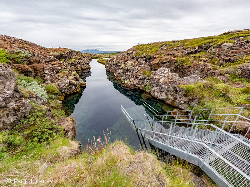
Entrance to Silfra Fissure
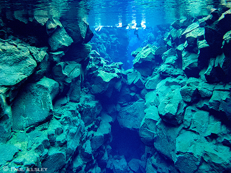
Snorkelers in the super clear (and cold) Silfra Fissure
To find this location on Google Maps: Click Here
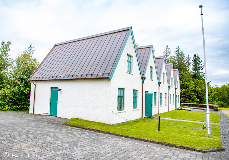
The Cave People of Laugarvatnshellar
The Cave People of Laugarvatnshellar
Driving 28km (27 min) southeast from Þingvellir National Park on Route 36 - Route 365 we arrive at the site of The Cave People of Laugarvatnshellar. For centuries these caves had been used by shepherds, however between 1910 and 1922 they were home to two different couples who made a living farming and selling ptarmigan in Reykjavík, and refreshments to people travelling The Golden Circle. This museum is a reconstruction of the cave home as it was in the 1920’s. This site is not normally listed on the traditional Golden Circle route.
To find this location on Google Maps: Click Here
Brúarfoss (Bridge Falls)
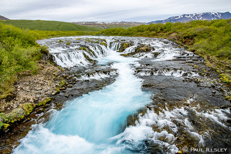
Brúarfoss (Bridge Falls)
Driving 24km (23 min) east from The Cave People at Laugarvatnshellar on Route 365 - Route 37 we arrive at Brúarfoss (Bridge Falls) trailhead. This picturesque waterfall can be reached by a 3.3km trail (each way) by which we pass two additional waterfalls (Hlauptungufoss and Miðfoss). The trailhead is located just after the bridge on Route 37. Be prepared for some muddy sections along the trail. We ould also park (for a fee) closer to the falls (about a 5-minute walk from the falls) by taking a side road to the falls just 625m before the trailhead parking lot. Either way, we get to see a truly unique little waterfall that is said to have the bluest water of any waterfall in Iceland. This site is not normally listed on the traditional Golden Circle route.
To find this location on Google Maps: Click Here
Geysir Hot Springs geothermal area
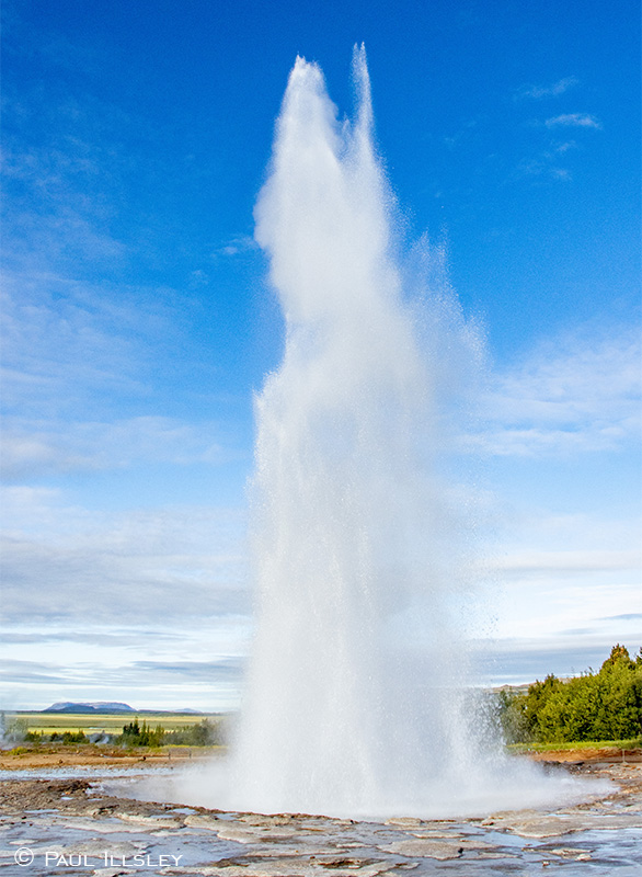
Strokkur erupting
Driving 15km (12 min) northeast from Brúarfoss trailhead on Route 37 - Route 35 we arrive at Geysir Hot Springs geothermal area. The most active geyser at this site is currently Strokkur (the Churn) which shoots hot water as high as 30 metres into the air every 7- 10 minutes. Strokkur is very easy to access (less than a couple minutes from your car). While we are visiting the area make sure to take time to walk along some of the short scenic trails to visit other bubbling pools and scenic outlooks found at this site.
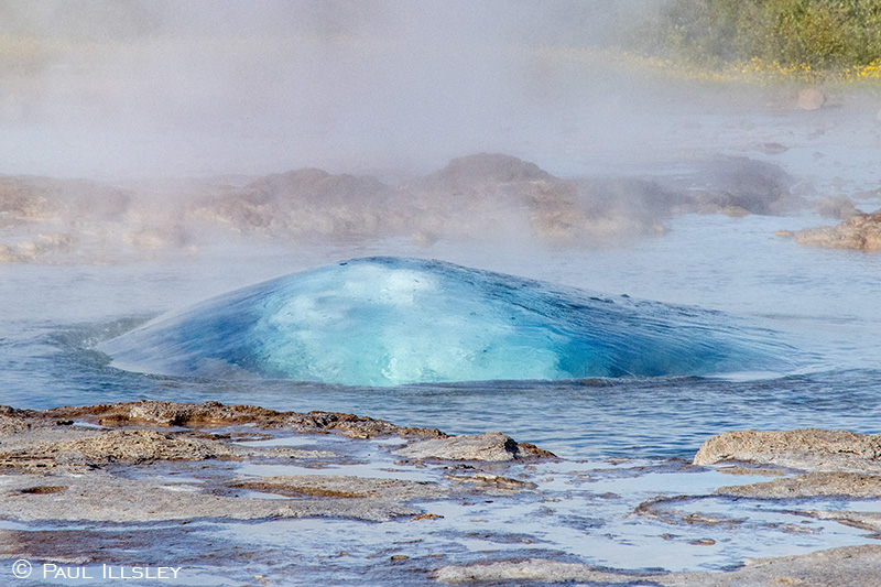
Strokkur about to erupt
To find this location on Google Maps: Click Here
Gullfoss (Golden Falls)
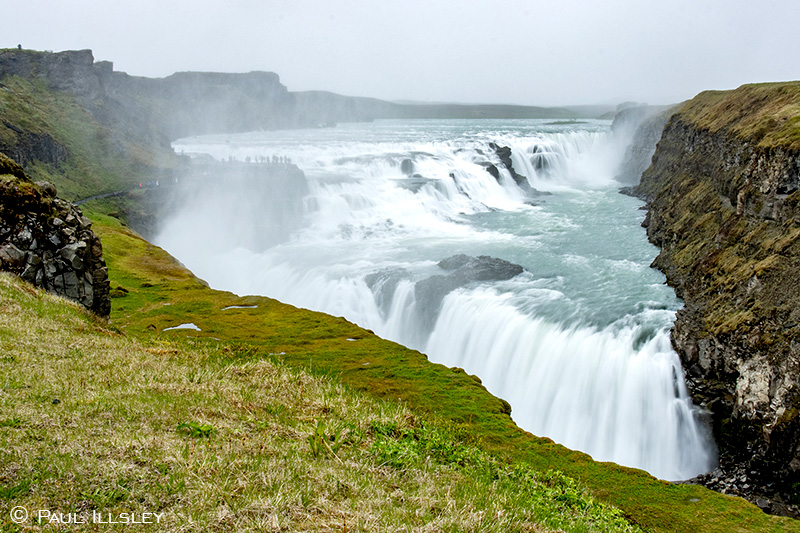
Gullfoss from lower parking lot
Driving 9.6 km (10 min) east of Geysir Hot Springs geothermal area on Route 35 we arrive at the famous Gullfoss (Golden Falls). This 32-meter-high waterfall is one of the most visited and impressive waterfalls in Iceland. Back in the early 20th century it was almost used for hydroelectric power but due to a local farmer’s daughters’ (Sigríður Tómasdóttir) tenacious fight; it was saved and is now protected as a natural site of national importance. There are four viewpoints around Gullfoss; the first viewpoint is at the lower parking lot, the second is a closeup view of the falls which is accessed by a short trail starting at the lower parking lot, the third is from the viewpoint above the lower parking lot near the top of the stairs, and the fourth is high above the falls which is accessed by continuing along an upper trail starting at the top of the stairs. There is also a restaurant, cafe and gift shop at the top of the stairs.
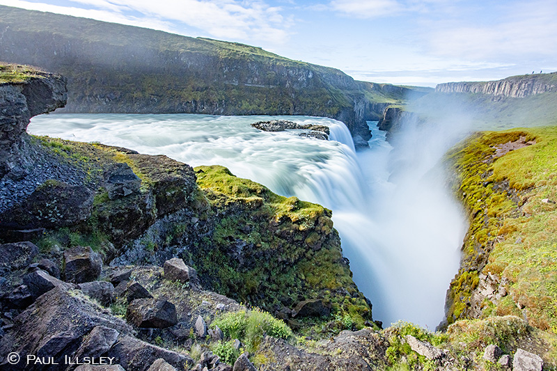
Gullfoss from the trail to the lower viewpoint
To find this location on Google Maps: Click Here
Kerið Crater
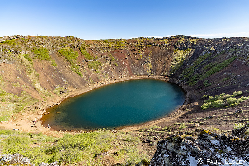
Kerið Crater
Driving 56km (50 minutes) southwest from Gullfoss on Route 35 we arrive at the Kerið Crater. This impressive 55m deep, 170m by 270m crater is located next to the main road making it easy to access. Geologist believe it was caused when the roof of a magma chamber collapsed after the magma filling it had drained out. The water filling the crater comes from groundwater seeping through the rock, and the water depth is usually about 9 m. You can view the crater from an easily accessible overlook platform near the parking lot, or you can walk along a 775m trail around its upper rim. You can also hike the short trail down to the bottom of the crater and walk the trail around the water’s edge.
To find this location on Google Maps: Click Here
Reykjadalur Hot Spring Thermal River
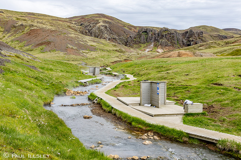
Reykjadalur Hot Spring Thermal River bathing area
Driving 27km (24 min) southwest from Kerið Crater on Route 35 - Route 1, we arrive at Reykjadalur Hot Spring Thermal River parking area after driving through the town of Hveragerði. From the parking lot we hike 4.6km (each way) on a well-maintained trail to reach the source of the thermal river (380m increase in elevation). Near the source, you will find a number of shallow warm water pools that have been created along the river by previous bathers. If you want, you can choose one to relax in a pool but make sure you continue along the trail past the pools to view the multicoloured algae coved rocks, and the geothermal vent that is the source of the thermal river.
The trail to and from the pools, and river’s source winds through some wonderful scenery so plan on at least 3 hours to complete your journey. Bathing in the river is only permitted in one designated section near the end of the trail. There is also a possibility of traveling along most of the trail on horseback. It is best to plan on exploring this site early in the morning to avoid the large crowds that arrive during the day (like many of the popular sites in Iceland). This site is well worth the effort it takes to reach it!
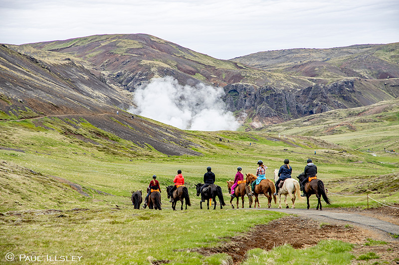
Traveling along the trail on horseback
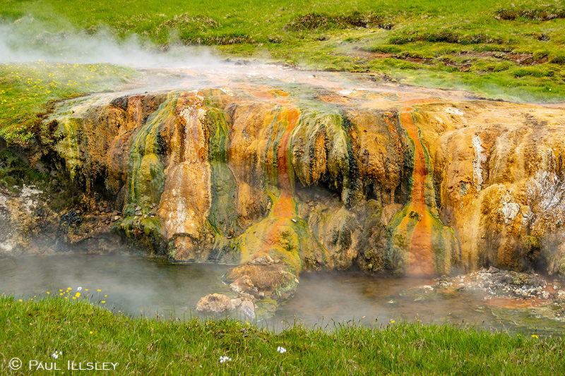
Multicoloured algae coved rocks
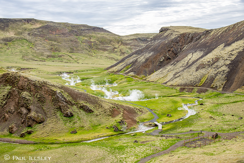
Reykjadalur valley just above the bathing area
To find this location (parking area) on Google Maps: Click Here
Rauðhólar (Red Hills) pseudo craters park
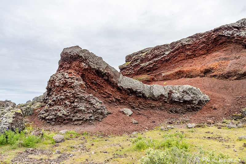
Rauðhólar (Red Hills) pseudo craters park
Driving 36km (30 min) northwest of Reykjadalur Hot Spring Thermal River parking lot on Route 1 back toward Reykjavík we pass Rauðhólar (Red Hills) pseudo craters park. This interesting little site is a great place to stroll around and view a bright red Mars-like landscape of over 80 pseudo craters. These craters were created when lava from a nearby eruption in the Elliðaárhraun Lava field came in contact with a wet swampy area, the resulting explosions of steam and rock created these fascinating formations. This unique 4 square km site on the outskirts of Reykjavík became a nature reserve in 1974, but prior to that, a portion of the area was used as a quarry for large building projects like roads and the construction of Reykjavík’s domestic airport.
The rocks in the area get their deep red color from the oxidization of iron in the lava which is over 5200 old. This park is popular with walkers, bird watchers and horseback riders (tours are available in the area). If we have limited time in Iceleand and can’t visit similar features in more remote sections of Iceland this park is a great place to view some of the islands unique and colourful geology. This site is not normally listed on the traditional Golden Circle route.
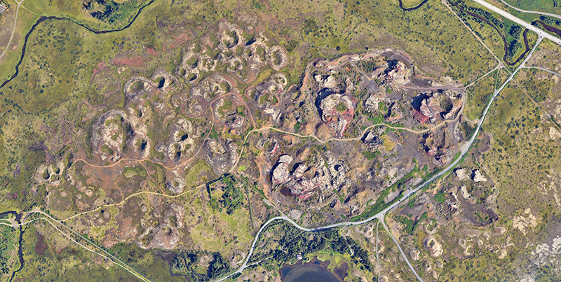
Google Earth view of Rauðhólar (Red Hills) pseudo craters park
To find this location on Google Maps: Click Here
Visit Paul Illsley's home page
|